Showing posts with label Osprey. Show all posts

Sunday, 19 July 2015

Cowboy Tough 3,5 days AR 2015- 7th overall, 1st Adventure class

Jason, James and I decided to do Cowboy Tough a few months ago but we didn't have a 4th.
We needed a 4th but most of all we needed a navigator so Jason wouldn't be on his own for the entire race.
That's when the race director put us in touch with Fritz (racer of Rev3).
We didn't know Fritz before and Unfortunately didn't have time to do a race all together prior the expedition.
We all flew to Wyoming on the Tuesday, Jason, James and I meeting up in Denver and then driving up to Casper while Fritz was supposed to meet us up there at about the same time.
After taking possession of what must be the pick up with the roughest suspension on earth, we started our drive and stopped on the way to do our groceries.
Fritz got delayed and delayed again and finally made it to the hotel past midnight...without one of his bags (that he got the next day on time for the race).
Wednesday was the check in and gear check, then race briefing and packing the boxes.
We managed to have a decent night of sleep before the race which is always a bonus in those races.
On Thursday morning we took the bus up to Buffalo where the race started.


Day1:
The race started with a small Orienteering course in town with different challenges: a shot of whiskey, punching a CP at the bottom of a 10-12 feet deep pool, collecting a telegram and a bullet casing. The orienteering was on foot and as soon as we were done we ran back to the TA (start), took our bikes and left for a couple of hours on the bike.
The first CP on the bike was a challenge. We got to a corral and were told that one of us needed to get in there and pick up a ribbon from a cow's tail (they were babies).
I heard a start of conversation in the team to know who was going and decided we didnt have time for that, so I jumped in...and then realized that I'm scared of cows :S but hey, I was in there, so I did my best and ended up getting one without getting hurt :)


Jumped back on bikes to get to the paddle.


There were two kind of canoes laying there and we picked the first one we saw that looked ok...big mistake. We ended up being passed by everybody who had the other kind of canoes. We thought they were about the same but there was actually 15 and 17 feet long canoes (if i'm correct).
Anyway the paddle was kind of painful because of the CPs not being exactly where they were supposed to be and one was not in place at all, which made us turn around for a while.
We saw the Yogas, Nuun, and Swiss Army turning around but we decided to try a little more to find it...without success.
By the time we came back, those teams were gone on the bike and we met them back up at the next challenge. In that one we had to guess a 3 letter word by flag signals. One or two persons were running to a far away field and were doing flag signals to make us guess a word.


We did relatively ok at it and were back on the bike quickly.
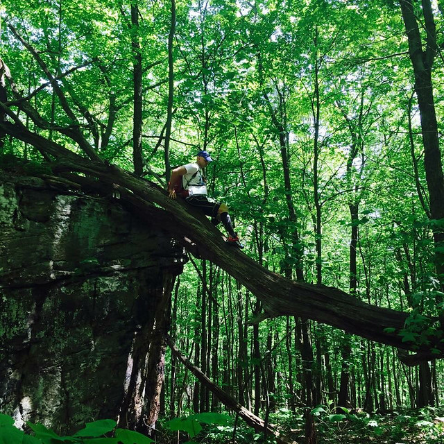
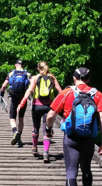
A couple of hours more and we were in TA ready to tackle the first big Trek that would take us up to 10 000 feet.
We started the trek with the Yoga and left them behind as we were climbing (one of their team mate wasn't feeling great). We had a great climb, passing a few teams on the way. Jason's navigation was awesome and we got all the CPs without any troubles up to CP 18. On the way down from CP16 we met Dart Nuun going up, which meant we had passed them somewhere on the way. We were moving well. On the way to CP18 Fritz started to have feet problems so we stopped for him to fix them. As we kept on going he started not feeling very well with GI issues that went on for the whole night. CP19 ended up being the race breaker for us.
The trail disappeared and we turned around and around for 4 to 5 hours. We were by then at 10 000 feet or close. I was feeling sicky from the altitude and just wanted to get back down. I really wanted to find that CP quickly. Fritz wasn't feeling any better at this point, so he couldn't help Jason which didn't simplify the situation.
After finally finding the CP we made another mistake going to CP20 that cost us another 2h+...the race was kind of over...we had missed a cut off.
The morale of the team went down and by the time we got to transition we didn't know if we would be allowed to keep on racing or not.


Day2:
They decided to put us on an "adventure class" course, which only meant that you had missed a cut off and were not forced to get mandatory points from there on but could get any CPs (mandatory or optional).
We decided to go for it and get as many CPs as we could, like if we were still on course.
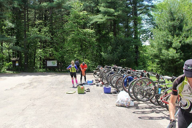
After a sluggish 1h45 transition, we left on the bikes. We reached the rappel CP pretty quickly and decided to go for more CPs instead of just riding to the End of day transition. So we kept on going on the regular route and picking up CPs. One of the CP was on the top of a mountain. It was so windy.
We decided to go to the end of day after CP32 (I didnt want to but got outvoted). That ride was ssssooooo long and boring. We did it all at night and it was just a repetitive gravel road with not much to keep you awake. That was our second night awake and we rode all night until early morning (we actually stopped for a 15min nap on the side of the road).
Day3:
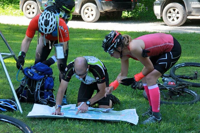
We got to TA and decided to go for some Optional CPs since we still had a bit of time. We hit two of them pretty quickly and messed up one in a creek that cost us a bit of time.
We got back to TA just on time to leave for Day3..on the bike again.
We rode a part of that bike ride with the Yoga. I guess we were kind of just following but we had to stop after a while and then we didn't know where we were. After turning around for a while we finally made it back on track...for 10 minutes before my first flat.
My tire was pretty new but had so many little cuts it was unbelievable.
The rocks were sharp I guess. We changed the tube just to get a second flat 2 min later.
James decided to cut open a punctured tube to make a protective layer for the new tube inside the tire...it worked.
We got to a CP at the canyon that was really pretty and even got burgers thanks to NYARA :)


Leaving there was again pretty hard (as every transition or stops we did) but we managed to get back on the road and picked up more optional CPs.

We struggled for a while and ended up not finding a CP at a well and decided to go to TA.
We got to TA end of day 3 after 63 hours of racing or so...and no sleep. We agreed on having a 2h stop which would include getting changed eating and sleeping. Alarm was set for 2am and we were supposed to leave for the orienteering course at 2:15am sharp....After barely 1h15 of sleep I was awake, looking at the map to see which CPs we would have time to get. By 2am I had a plan and was ready to wake the guys up.
That last TA was a nightmare to leave, and we ended up not getting out of the transition until 2:45am. But Hey at least we went...We picked up the first 3 Cps easily and decided to go for a couple more...problem is we went way too far and ended up picking up a CP we didn't plan to pick and missed the two others that we wanted to take closer to us...it was a bit of a rush to get back in the TA right on time to not be cut off and jump on our bikes.
Day4:
The bike was a 70 mile bike ride back to Casper with some elevation, especially at the start. We managed a good pace and within half the bike ride we had passed many teams.


The second half of the ride was my favorite.
We rode in an echelon formation with Nordic adventure racing team for a while and that was very cool. After a while we decided to go just our team and we took off. It felt fast and great.
By the time we reached town we had reached and passed a lot of teams. We got to the last TA where we took our packrafts and ran to the put in 3 miles upstream. We picked up our last CP and went down river in no time thanks to the current.


Arriving at the finish line, Jason and Fritz decided to race James and I to cross the line first :)


In summary a lot of fun but very disappointed to not have stayed on the full course. We were fit and fast and I am more than sure that we could have done great if only we could have helped Jason with the nav a little more when he needed it. This is the second race that Jason, James and I have done together and once again I loved racing with them and would do it all over again anytime.
I didn't mention it too much but I did spend my time freezing my butt (I really thought it would be a warm race) and when i wasn't freezing I sunburnt real good :/
On a super positive side I loved my Altra Lonepeaks to bits. I didn't have any feet pain which is really rare for me and my 2XU and Pearl Izumi clothing and equipment worked really well. We rode 392km in 3,5 days and I didn't get a rash. First time ever and I only used cream once prior to the race...I am stoked!!!

Frenchie

Photo credits: Michael Sero and Randy Eriksen, two kick ass photographers

Monday, 25 May 2015

EQUINOX TRAVERSE 2015- 44H AR- 3RD CO-ED TEAM, 5TH OVERALL

Jason, Nathalie and James as a 3 Person Co-ed Elite team.

Map handout began at 7:00am where we had 90 minutes before the pre-race meeting to transfer all of the off-limit roads, allowable crossing locations and the control/TA locations from a master map set hanging on the wall to our own version. In addition, we had to divide up the gear, batteries and food into a small team bin and a paddle bag and come up with an optimal route for the next 44 hours. In theory a 3 person team should be faster than a 4 person team racing but we certainly could have used a 4th set of hands to get everything done prior to the start. As we lined up I was confident in the first bike route and the following trekking leg but was uneasy about the route I had partially planned for the huge second bike leg. The rest of the course was to be divulged later on the course.

A neutral start helped keep things sane until we hit the first climb when we were allowed to take off. We kept the pace somewhat comfortable on the long climb out of town as we paralleled the Laurel Highland Trail and managed to open a gap on everyone but one solo racer. Once at the top it was a fast rip downhill passing 2 cp’s and yelling out our team number as we went. The route was pretty straightforward with the exception of a short powerline bikewhack, then onto a rail trail I had not been on previously which took us to TA1 at Camp Christian. Within a few seconds we were joined in the TA by Rev3, Odyssey and AAS.
Mtn Bike 1:47:00 [3] 30.0 km (16.8 kph)
All teams left at about the same time but with different route options so it wasn’t long before we were by ourselves on our way to the first cp on the island. From there it was a 6k rail trail run to the remaining points on State land. The USGS map only showed a few old logging roads but we soon discovered a number of unmapped versions that we followed to a majority of the points using the ridgeline as a handrail. image

Clue: Top of boulder


None of the points proved too difficult aside from the fact that they were 1000’ above the rail trail. Once we punched them all we descended down to the river and retraced our steps back to the TA along the railtrail which we noticed was slightly uphill the entire way. Something that went unnoticed on the way out.
image


As we approached the TA we ran into Odyssey where two trails merged and we ran into the TA together. AAS was just a few minutes back and the arrived as we were still transitioning.
Trek 5:17:00 [3] 31.0 km (10:14 / km)
While in the TA we put together the rest of the route for the second bike leg and headed out.
This was a big bike leg, both distance and climbing. We used the USGS map to get us to the Roaring Run Natural Area where a majority of the controls would be. We had transferred the control locations from the USGS map to the park map which had more options for roads and trails making getting to the area of the controls easier. Unfortunately it also made locating the actual controls once near them a little tougher as there location had been transferred (quickly) 2x from the original map at this point and we had to do a little more hunting for them than we should but fortunately James is quite the bloodhound. We were still seeing AAS and Odyssey every now and then so we were making good progress regardless. image
"Looks like lots of climbing"
Around 1:30am our plan began to fall apart. We had just punched the Warming Hut control, our last control north of rte 31 and were heading towards one of the southern controls when Odyssey rode past us going the opposite direction which told me we were ahead of them. Then to our surprise as we were riding endlessly downhill towards TA4 we saw Odyssey and AAS heading uphill towards the southern controls from TA4 which was confusing. “They couldn’t have punched all the southern controls already…”. The clue sheet indicated that all of the controls north of 31 had to be punched before checking in at TA3 at 4am. We took this to mean that no other bike-O controls could be punched after leaving TA3 which wasn’t the case. All of the points south of rte 31 were still in play on the way to TA4 but for some reason in the fury of getting everything together we didn’t grasp this concept and tried to clear all of them before punching at TA3 (Cogo’s). We nearly pulled it off as by the time we hit TA3 we had all but 2 punched.

At this point we knew we had thrown the chance at the win away. In addition, Nathalie was extremely cold from the downhills so we spent some extra time at the TA (why did they call it a TA anyways??) eating 2 slices of pizza, a bottle of Gatorade and a bottle of Musclemilk each before heading back out to climb past a number of the controls we had already been to on our way to TA4. I’m sure it took a lot for Nathalie to walk back out into the cold for more biking given how cold she was with little chance for the win but there was no apprehension when left. We quickly warmed up with more climbing and the sun came up just as we rode past Seven Springs Resort and punched our last 2 controls on our way to Bear Run.

The entrance to Bear Run was at a marked waypoint and the route was flagged which we found to be the case until it stopped at a trail T intersection before reaching the TA. The USGS map didn’t show a clear way to the TA4 from there and I took us on a circuitous route with 2 bikewhacks to get there.
Mtn Bike 17:40:00 [3] 177.0 km (10 kph)
Bear Run O-course- When we arrived we were given a Bear Run trail map (would have been handy about 1 hour earlier) with 6 controls. At this point AAS and Odyssey had been on course for 2 hours so they were out of touch and we were now racing against Rev3 who had just headed out when we arrived. They had elected to drop two of the bike-O controls so we had a slight cushion to work with. At the TA we were also given the details for the rest of the course. After the O-course we would ride to Confluence to the paddle put-in, paddle to Ohiopyle on the Middle Yough followed by a 4 control trek back to Confluence and then a rail trail ride to the finish. We had to put-in by 6pm and be off the water by 8:30pm. image

Hot TA!

Given all this info we decided to drop one out-and-back control on the O-course to ensure enough time for the biking and paddling. As we arrived back to the TA Rev3 was there getting ready to take off towards Confluence. Orienteering 3:47:00 [3] 12.0 km (18:55 / km)
Despite having spent 4 hours on the Bear Run map I still tried to make it longer than necessary before hitting the flagging tape which led us back out to the waypoint. Rev3 passed us somewhere along the way but then we ran back into them again just before the put-in.

Mtn Bike 3:27:00 [3] 24.0 km (7.0 kph)
With the heat of the day on us the paddle down the middle Yough was very enjoyable. Our reward for the fun was the requirement of carrying the rafts 1k into town from the take-out.
Kayak 1:45:00 [3] 14.0 km (8.0 kph)
Back in Ohiopyle we were given 4 trekking controls to transfer onto our maps, two of which I’d been to before near Sugarloaf and the firetower. Knowing that we had one less point than AAS and Odyssey and one more than Rev3 we were pretty well locked in to third place. Nathalie transposed the control locations onto a park map and entertained us while brushing up on her navigation skills. Near the firetower we ran into Rev3 again and made the descent down to Ramcat and the bikes together.
Trek 6:58:00 [3] 23.0 km
Due to a flat rail trail ride and the enticement of sleep we quickly transitioned and made quick work of the last leg finishing up just after 2:30a Monday morning as the 3rd place Co-ed Elite team.
Mtn Bike 45:00 [3] 14.0 km (18.7 kph)
Thanks to American Adventure Sports for a challenging and fun course. All three of us have raced in the area previously and agreed this was the most-enjoyable version we’ve raced on in the area.
Jason

Sunday, 17 May 2015

RAID PULSE 8H AR-1ST SOLO FEMALE

For the first time in a couple of years I learnt that there were 3 girls racing solo so we would have a category of our own (I was racing against the guys up to then).
I was excited and nervous at the same time.
The race was a bike start on the road and up to Mont Ste Marie to ride pretty much all the single tracks there.
The rain started as we lined up at the start line. My stress level increased a little knowing that we were going on single tracks with roots and wooden platform that would become very slippery quickly.
I felt good and stayed with the front pack leading to the trails. I decided to climb up to the advanced CP first and make my way back from there. On the way down I missed a turn which forced me to go and do an extra loop. I wasn’t super happy with that but pushed to the TA to the trek where I arrived after 3h of biking (and pushing the bike up that monstrous gravely and sandy road).
When I got to transition I noticed that another solo girl was there. I had kept her behind me on the bike and blamed the fact she passed me on my extra loop. I did a pretty quick transition and left with her to the first CP. After that I decided to take a different route so we wouldn’t be racing together and maybe I would make some time. Orienteering when it’s pure bushwacking is not my strength. After a few CPs I lost my passport so I waited at a CP to see someone and punched my map. My moral went down a lot at that point. Nicky (firend and other solo female) showed up at that CP and we went to the next one together. After that CP she decided to go and do some of the CPs I had done before whilst I had to go and pick up two advanced CPs a bit further away.
I left transition a little too quickly and forgot my map case on my bike. By the time I reached the advanced CP my map was crumbling apart and I couldn’t see much. The transition dot had disappeared and I couldn’t tell the numbers of a few CPs. At that time I was racing along with a coed team and decided to stock with them since I didn’t know how to get back.
When we finally reached the TA the volunteers told me the other girl had left an hour prior. The cut off to do an advanced bike was supposed to be at 2:30pm but they decided to extend it so she was able to go, even if she got there at 2:35pm.. I wasn’t happy but I learnt that she didn’t do all the advanced CPs on foot so maybe I had a chance to catch up. The way It worked is that each CP regular and advanced worth 25 points so if she didn’t get the two CPs on foot but got the two CPs advanced on bike I could still maybe catch up on the paddle and still finish ahead. So without hesitation I took my bike and went away.
That’s when it got better…I left so quickly that I didn’t put my map in my map board on the bike but on top. Going down the massive hill pushing the bike I didn’t realised but I lost my map. Once at the bottom I tried to look where to go and Oh surprise..no more map. So once again I tagged along with some guys until the paddling section where a volunteer gave me his map so I could navigate on the water.
I am ready to go in the boat and I am decided to have a good paddle to compensate all those mistakes.
Where is my boat??? I am looking around, my boat isn’t there! Then I realise that James’s boat was there. James being shorter than me I had to do the paddle section with my knees in my face (didn’t have a screw driver to move the pedals) not very stable with power boats round.
I met James on the water and wasn’t happy…he didn’t realised until I told him what happened even if our boats are two distinctive colors (he did apologize and cleaned my bike at the ned of the race so we are all good :D).
I saw the other girl just a little after seeing James and I knew it would be hard to catch up. She was maybe 10min ahead. At the end of the paddle I jumped on the bike and tried to hammer it to the finish but didn’t catch her. I passed the line not super happy with how my race went and the many mistakes I had done during the day slowing me down so much. To my surprise I finished first solo female. What I didn’t know is that she had missed another CP on the first bike. I had then 25 more points woot woot.
Pretty happy with the result at the end of the day despite all the mistakes I made. I t was a tough course with lots of up and downs…literally…Can’t wait to see the overall results. Thank you Raid Pulse for once again a great and well organised event.
I will be back in August, a little less distracted this time.
Thanks to Nuun and Pacific Health Labs products for keeping us fueled and hydrated throughout the day. I also tested out my new Osprey pack REV6 and I loved it to bits. Perfect AR pack for short races (4-12h).

Nat

Sunday, 30 November 2014

ADVENTURE RACING WORLD CHAMPIONSHIPS ECUADOR 2014- 19th OVERALL

This is a re-print of a race report posted elsewhere by Pete Cameron in late 2014 detailing our exploits at the 2014 ARWC. Enjoy!

--------------------------------------------------

Ecuador. Rumour has it that Quito is the highest capital in the world. Lee raced there in 2010. Liza and Bob raced there a couple of years ago. The 411? Friendly people, beautiful country, outgoing race organizers…altitude is a bloody killer. 

ARWC 2014. An expedition adventure race skirting along the 0° equatorial line, featuring the Andes highlands, Amazon basin, and Pacific coast. 700+km. 7+days. James, Harper, and Nathalie need a teammate and have asked me to join. What am I doing?...Yup, I’m in. 

How does one living in Annecy get ready for a race at altitude? How does one fit in the requisite training amongst being a Dad, a husband to a pregnant wife, and a very involved Product Manager at work? This adventure racing addiction of mine is getting harder and harder to manage. Thankfully, I continue to have the fire in my belly to make it happen each year…and a supportive wife who is just as addicted as I am. 

Knowing that Ecuador isn’t known for its paddling, I gambled and spent the majority of my training time on a road bike, climbing thousands of vertical metres in the French and Italian Alps. Forclaz, Semnoz, Aravis, Colombier, Giau, d’Huez, Galibier…I continually added to my collection of Cols achieved, did a few road cycling races, developed a sixth sense of % grade, and gained a sick enjoyment of cranking out challenging climbs on my small chain ring. 

Of course, I hit the trails on foot, too. I came up with all sorts of little tours that showed off a particularly cool part of the landscape near our apartment. I was regularly up at the crack and went out late at night for a trail run after putting Mari to bed. We spent a long weekend in Briançon, a town to our south where it’s relatively easy to get up to 2,700m along jagged yet runnable ridgelines. My climbing legs got stronger and I have grown fond of technical downhills. 

We received a Competitor Newsletter and it confirmed that this year’s ARWC would be won and lost on the bike and on foot. Paddling was only 16% so the nighttime solo paddles in Lac Annecy in my 17’ fiberglass tripping boat a couple times a week would likely be sufficient preparation. It also confirmed that we would be above 2,700m for quite a bit of the race. Shit. This is going to get interesting. 

* * * 


We were into thin air right from the start – a 29k trek within the Antisana Ecological Reserve starting at 3,900m alongside the Antisana volcano (5,758m). Quite honestly, I feared the worst and hoped for the best. Both Nat and I have troubles with asthma and we’d soon be climbing up to a pass that topped out at 4,400m. Given the suffering I had had in Costa Rica last December at altitude, I was humble about my expectations for speed off the start line. 

‘Tranquile’, I nattered en francais to Nat about what our pace should be. I was telling it to myself, too. While a few teams blasted away off the start line, most had a conservative tempo. Go too fast and your heart felt like it was going to beat out of your chest. Stop for even just a minute and all was back to normal. We trotted along conservatively, made the pass, and navigated our decent to Laguna Tumiguino at 3,660m. 
There was a definite congo line of sorts using various trails and given that we could see for kms in every direction, navigation was decently straight forward. The tricky bits had to do with the fact that the contour interval was 40m. A lot can happen in 40m of vertical distance – entire hills, valleys, and spurs simply didn’t make it onto the map as they weren’t ‘significant’ enough. I’ve gotten used to this over the years but it doesn’t make it any less problematic from time to time. The other tricky bit was that lakes and ponds weren’t filled in blue on the map; there was just a blue outline. 

The going got technical as we continued to descend – we skirted very steep lake shores with minimal bank, ducked through thick foliage, negotiated stream beds, and eventually made our way out onto the volcanic rock we were warned about. While easy to gain purchase on, you really, really don’t want to fall onto this stuff; it was sharp. I don’t know if we took the best route or not but I felt it was easy to stay high and skip along from rock to rock, leading to a road that CP1 was on. Most others dropped down through the thick vegetation, across a flat and then climbed back up. ‘What ev’, we bagged the 1st CP with no botched up navigation…first objective met! 

We subsequently trotted 5k along the dirt roads to the TA with a few other teams. Foursome after foursome whizzed by us on their bikes as we neared the transition and we soon learned that we were in 25th place, exactly halfway through the 50-team field…sweet mediocrity. 

* * * 
Getting onto the first bike section typically takes a little bit of extra time. It’s the first time into your bike box and you haven’t yet established a slick rhythm of assembling your bike. Given the paltry 25kg weight limit on our bike boxes, mine was mostly empty as my bike weighs the most amongst our team – we even had to carry one of my bike shoes on the first trek so as not to exceed the weight limit! I found a way to get my XL-sized 29er into my bike box with only the pedals, seat, and wheels to put on so it made me decently quick in TAs to and from the bike. 


This next ride was 67km and would be very much a net downhill; 1,800m to be exact. Most of the ride was on roads but nearing the end, it was hike-a-bike time. While I’m a pussy riding downhills on my road bike, I’m significantly more confident on my MTB. I opened up the speed as we got onto the asphalt and almost immediately met with (idiocy and) disaster. As I was clipping along at 60+kph, I mistook the angle I’d need for the left turn and starting careening for the curb, guard rail, and whatever lay beyond. Feathering the brakes, so as not to get into a skid, and unlocking my left foot from its pedal, I somehow managed to stop the speed wobbles, ground only lightly against the curb with my rear wheel skewer, and escaped with no more than a heavily beating heart. Stupid, stupid, stupid. I looked behind and luckily my teammates hadn’t rounded the corner yet to see my recklessness. That little blunder remained my secret for a few days. 

While the scenes were beautiful and easily enjoyed as we cycled along the paved road, there were too many cars for my liking; this was an adventure race after all. Before long, we were alongside a feeder river to the Amazon and hauling our bikes along unridable, mucky trail…that’s more like it! We each fell a lot, took some sticks to sensitive parts, swore, and tried to get this done before darkness fell. In hindsight, this took a bit too long and that was the reason I couldn’t believe how far we’d only traveled in the ~3km hike-a-bike. Onward we went into the next TA in the multi-sport centre at El Chaco, where we were gawked at by myriads of sporty locals. 

* * * 
We trekked north out of El Chaco on a road that would lead us to the more rugged part of the historic El Chaco – Oyacachi Trail; a route that links the western and eastern sides of the Andes mountains. Apparently, Ecuadorians have used this route for decades. These traders were a lot harder core than us, as we complained for much of the next 44km and 1,500m of ascent. This was hard going. I struggled for a bit with the nav while trying to locate the first bridge across the raging river (although I feel better now that I have seen that Team UK adidas TERREX made a similar bobble as I did). We lost about 15 minutes or so, negotiating the fog, barbed wire fences, and darkness but we poked through the bush eventually, right at the bridge’s beginning. The bridge was in rough shape. How rough exactly? Well, it was a hanging, wooden-planked bridge with not so many planks left. Exposed nails were everywhere and the river raged below. Thankfully, there was a rope system set up for us to be able to clip into as we traversed it. I later heard that a few unlucky racers stepped into the abyss, only to be saved by the rope. Luckily, we got through unscathed. 


I really, really wish that we had had more of the next 15km in sunlight. It would have made our first real introduction to Ecuadorian mud trails more palatable. The route itself was actually quite simple – trek west and stay north of the incredibly violent sounding Rio Oyacachi. Moving along the route, however, was anything but that. The trail had a way of braiding from time to time (with the incorrect braids ending abruptly in a mess of jungly muck and thick vegetation), disappearing altogether, getting deeper in mud, and overgrowing with substantial Amazonian foliage. Nat and Harper were getting pretty frustrated in there, we were all stumbling along, and I stressed from time to time with trying to find the best route. Our pace slowed, other teams went by us, but we plodded along and exited a short time after the sun rose on Day 2. 

I don’t remember much of the next 14km trek along the dirt road to the TA. I do remember telling my teammates that the road would cross the Rio Oyacachi twice before we reached the TA. Sadly, that didn’t jerk my memory to a note I had seen somewhere in the litany of paper work we were shown or received. We were to “never cross the river” as we traveled west to the TA. Only Teams NZ Seagate, SWEDEN Silva, and POLAND Polska respected this note and avoided a 4-hour penalty. Fair enough, I say. However, I am convinced that this was an oversight on behalf of the race organizers. All previous out-of-bounds sections were carefully marked in with RED Xs on the provided maps; this one was not. This ‘set back’ took us all of about 4 seconds to overcome as it meant nothing to us, we would need the sleep anyway. 

* * * 
We were back over 3,000m again, the start of a 144km bike leg which would see us climb to ~3,800m. I was still worried about the prospects of altitude sickness even though it hadn’t seemed to affect us so far. So once again, we were in conservative mode as we made the initial 800m ascent. I felt strong and was able to tow Nathalie on the climb. Unfortunately, as we moved forward, we saw Liza and the rest of Team USA Bones coming back toward us. “Jason’s sick…we’re out!”, Liza yelled as they flew by. I had pegged them for another top 10 finish this year but as with most adventure races, anything can happen to any team. 


When Harper and I put the maps together, I took forever plotting a route through what was a maze of roads, trails, and whatever else looked rideable on the topo maps for this long ride. What made it more complex was the colour scheme of the maps themselves – there just wasn’t that much difference between contour lines, roads, and other political boundaries. It’s no wonder that after analyzing our route versus other teams’ on the race website, the whole GPS tracking page looks like some of my daughter’s early artwork. It must have been comical to watch online; kind of like Monty Python’s 100m dash for the directionally challenged. 

Our journey was only 25km old when darkness began to fall. Surrounded by a couple of other teams in the twilight as we all tried to make sense of the maps versus what we were seeing, I tried to soak as much of the landscape in as I could. In the end, I had us turn tail and take a different route than originally planned. I didn’t relish riding on a broken trail in the pitch black and opted for roads instead. A good decision in hindsight but even these roads weren’t easy going. Ecuador has a lot of mud. So, instead of building dirt roads, they often fill these in with 5-pin bowling-ball-sized rocks. It must have been back breaking work. Riding on these roads made me appreciate my full-suspension bike. 

Thankfully, my eyesight is pretty good so when I squinted to follow our progress through village after village and left turn after right on bumpy roads, we didn’t have to stop too much. Before long, we were atop the last high point of the ride and had to make a fast descent to what was indicated as a railroad. It was a navigationally tricky section as one wrong turn at speed and you’d face the wrath of teammates who were forced to climb back up to a correct turn. We got down OK and into the village I wanted. I took a gamble on a small trail that was going in the correct direction and it turned out to be the right one; the abandoned rail line should be 2km away. It was time to sleep. It was also time for the dogs to bark non-stop as we tried to rest on someone’s porch at 2h00. They didn’t stop for the whole hour and decided to silence themselves as we got up to move onward. WTF? 

None of us knew exactly what to expect from the rail line and it took a bit to find. It was to be a 10km section where we simply had to nail the exit point. Lose track of your progress through the twists and turns and you’d never really know where to get off to get to the next CP. Needless to say, I was a little nervous. We made it about 100m on the rail line before it ended. Confused, we looked around and slowly realized that what we were on wasn’t the rail line, the concrete bed 3m below us was; with full on tunnels to go through. Unfortunately, drainage of the concreted bed was non-existent and it was a constant puddle of up to 50cm of water. This wasn’t going to be the quick and smooth ride I had hoped for. It never is in adventure racing somehow. Some tunnels were under construction (gawd knows why) and a latticework of wooden beams had to be climbed through with bikes in tow…in the dark, of course. Harper and I got wise about 2km down the track when we could climb back up and out of the concrete bed…there had to be an access road beside this thing like there was at the beginning. And as luck would have it, there was. We later nailed the rail line exit to the CP and started the next maze. 

On the night before the race, I spent the better part of 45 minutes using Google Earth to figure out our nav plan for the next 5-10km. Where has the purity gone?!? Don’t judge me, everyone does it now. Anyway, we had to get off of an elevated head of land and descend to the west. I couldn’t find an easy way down. I zoomed in really closely and saw two different switchbacks. Sweet. I plotted a route on the maps through the labyrinth of roads and looked forward to making it happen during the race. Well, now it was the race, and while I made all of the correct turns, it wasn’t happening. We hit a dead end where I wanted to turn north. There was less than 200m of fenced-in private plantation property between us and the switchback I wanted. Sh!t. We did find a VERY rugged-looking trailhead but after speaking to some locals (at 4h00!), they were clear in that we really shouldn’t try to descend there. We talked to a few more folks (I say ‘we’ but what I really mean is ‘James and Nat used their impressively sufficient Spanish skills’) and ended up on a single-track down the elevation and to the west. Like the post-race analysis addict I am, I dug into other teams’ routes on that section. It looks like the top few teams DID take the crazy steep single-track at the dead end that we reached while a whack of others did as we did, or worse, biking left and right in search of the way off the plateau. 


The last 70km of the ride was a roller coaster of ups and downs. We were steady, didn’t make any wrong turns, ate, drank, and rolled into the TA in around 21st place with a comfortable amount of time before the cut-off of having to leave onto the next trek. Comfort turned into a bit of extra drama when organizers extended the cut-off and teams arrived, gasping for air from riding so hard to beat it, only to find out that they could still continue on the full course. I took the time to fix my feet as blood blisters had formed underneath a few of my toenails and needed the requisite relief only a lighter and sharp needle can provide. Nat, however, was in a more serious situation. She had fallen off her bike earlier and according to the medics, had dislocated a bone in her wrist / hand. They could put it back into place. I’m sure it bloody well hurt but Nat wasn’t about to have that stand in her way. She took the painkillers, had the medics do their thing, and that was that. At least we wouldn’t have to ride again for a while. It was time for another rest and after scoffing back some local fare from an entrepreneurial local, we attempted to sleep for a couple more hours, now well into Day 3. 

* * * 
We had escaped the wrath of altitude sickness. We had avoided any cataclysmic navigation issues. No race-ending mechanicals on the bike had stopped our progress. No one was sick. We were in a good place given our goal of finishing the entire racecourse and ranking in the top 20. And then came hypothermia. 

I’ve since seen pictures of the next 45km trek, featuring an 1,800m climb to a CP, high above the TA amongst beautiful ridgelines and steep canyons. During the race, I saw nothing. Night had fallen, there’s no light pollution in the Ecuadorian backcountry, and the fog is bloody thick. We got onto the correct ridgeline climb no worries but when the trail disappeared from time to time, it became really difficult to get onto it again. There were barbed wire fences everywhere and even with modern, high-powered lighting, we could only see 10-25m ahead of us at times. It was slow going after doing so well to get up to 3,000m again. A road lay somewhere down below us but even though it eventually went where we wanted to get to, it went far out of the way and would be a lot of extra distance on our sore feet. Backtracking a little, we gained the rhythm of the trail and fence line – they crossed each other again and again and ducked into and out of thick vegetation. An even higher ridgeline began to appear through the fog (when I asked that all turn off our headlamps to see ‘better’ by the moonlight!?!) that would get us to the attack point for the next CP. And then the sh!t hit the fan. 


Now soaking wet from all of the fog and tall grasses, we gained the high ridgeline and started over the other side…but, too early by about 400m! Only one loop around the track. It can make the difference between success and failure at times, even in races of this length and duration. Damn. Hindsight truly is 20/20. The little out and back on the online tracking seems so innocuous but in reality it was anything but. It was increasingly steep and very thick with seemingly impenetrable vegetation. James cut us a path. He grunted, ripped away the bush, snapped branches, and on we plodded. I didn’t like it. It didn’t feel right. I’ve learned to listen to those navigational ‘spidey senses’. “Guys, I’m sorry but we’ve got to turn around and go back up”. A call from James below, “Pete, get down here, we’ve got a problem”. 


Harper and Nat were freezing and shaking more than normal. Again, James buried his head and cut us a route back up. It was tough work. “Pete, I’ll get them warm…you get up there and figure us a route out of this place”. I still couldn’t see anything but the objective was clear – get to somewhere less exposed and get these guys warm. This is race-ending type of stuff. Some sort of karma reward kicked in shortly thereafter and the sun began to rise. I realized my 400m error and bushed it back to my teammates. Harper and Nat seemed much calmer about the situation than James or I did. The tent was out, sleeping bags were on, and everyone’s clothes were dedicated to our two, near-hypothermic teammates. 


We dodged a bullet overnight on that ridge. Now that the sun was up, everything seemed better. Getting on track was easy and we were on our way forward. Amazingly, Harps and Nat were back to normal very quickly. Heading for the next CP, we learned that this area played havoc with a collection of other teams, too. The built infrastructure was quite different than the maps indicated and even the next CP seemed in the wrong location. Teams had lost a lot of time in here. Without our hypothermic ‘break’, we too may have succumbed to a navigational vortex but after a short while and a bit of reckoning, we hit the mystical CP14 and were on our way…into a part of the race that I really cannot remember too much of. 


Why? Because I slept for most of it. We descended 1,500m on a truly heinous ‘trail’ for who-knows-how-long and I only recall bits of pieces of it. The stress of the previous night’s navigation challenges as well as dealing with Harper’s and Nat’s personal safety had stretched me and now I was cooked. I stumbled along this ‘ancient smuggler’s route’ (once a transport path for alcohol and sugar cane) and couldn’t understand what I was walking in the midst of. The trail carved 2-3m into the rock at times. Other times, vegetation grew overtop so it was like walking through a tunnel. I remember waking up from my sleep walk, seeing no one, and not being sure of which direction to go. Salomon SpeedCross 3 tracks in the deep mud helped me out again and again. Give that Product Manager a raise! 


Even at the bottom and after taking time to fix my feet (again), I was still phuct up. I couldn’t make sense of the map. The lines on it were a mystery. It was too complex. We walked right by the CP15 landmark that we were supposed to take a picture of to prove that we were there. I felt badly on the 3km out-and-back afterward but I was honestly so mentally tired and needed a break. We stumbled into the TA in around 23rd place and it was definitely sleep time. 


* * * 
We happily ‘served’ our 4-hour penalty at the TA, just over halfway through Day 4, copping Zzzzzs for much of it. I needed it. Our original plan was to try to hit the white-water paddle that followed this next bike ride just before daybreak so as to minimize stop time due to the dark zone (eg. we weren’t allowed to paddle outside the hours of 5h30 and 18h30). This was out the window now and we’d have to roll with it. A very challenging 159km bike section lay ahead of us and anything could happen. 


Now at much lower altitude, the vegetation continued to change and become more and more lush. We biked all day through beautiful scenery with sporadic grinding climbs and quick descents thrown in. Ice cream, Coke, cooked eggs, chips, and anything else we could get our hands on from the local shops was greatly appreciated. I felt good after an extended sleep (imagine that!) and was able to tow. It was hot out and while we were moving well, we needed a catnap in a school field about halfway through. Dump truck after dump truck rolled by, as they are building a massive hydroelectric damn in the area, but we didn’t hear a thing. 

The maps were a little tough to follow at times with entire villages being omitted. James and Nat’s Spanish helped us out again and again, however, and we avoided any nav bobbles. We hit the ropes section for a bit of contrived challenge – a tyrolean traverse and high-wire crossing over a raging river. Nat’s a bit timid when it comes to heights but she did just fine. Two teams had arrived when we were back to our bikes which I think was a good thing, as it put a bit of fire into us for the remaining 28km along bumpy and rutted out gravel roads. We had a bit of a scare when Harper got a flat. His spare tube had a hole in it and the patch kit just wouldn’t fix the problem. As a last resort, we jammed a 29er tube in there and it worked perfectly for the rest of the race. 

Darkness fell once again and Nat seemed to speed up. She admits to being a bit hesitant on technical sections while riding. However, with no sunlight to see how technical this road really was, she attacked it and we rode alongside each other for much of the rest of the ride. Passing by a very injured Team ITALY Freemind, we were reminded of how tenuous a hold on finishing the whole racecourse can be. Their female teammate had a horrible infection in her hand, couldn’t ride, and so two of her teammates worked together to push her on her bike on either side of her so she didn’t have to walk. 

* * * 
I don’t profess to be a talented white-water paddler. Angus Doughty often joked about me needing to work on some ‘basic skills’ before attacking rapid sections in races. Harper is about as talented and cautious in white water as I am but James and Nat, however, enjoy the rapids and I think looked forward to this 60km paddle on the Rio Grande. While it started out decently tame, with a few class I sections, it got increasingly angry as more and more water joined the fun from the river’s tributaries. Class II and even a couple of class III were marked on the map. A guide warned us beforehand that we’d be swimming for sure. I figured as much when I laid my eyes on the sit-on-top kiddy-esque boats we’d be paddling. I’m too heavy for that sh!t. 

Harper and I were doomed from the start. I took the first rapid like Angus would – cautiously and controlled. Harper didn’t like my rear-angled entry into the rapid and I didn’t like his failure to actually put his paddle in the water. Some heated exchanges were had but we didn’t dunk…yet. 
We got smart when we hit the first class III. We lined the boats down. Not one team had gotten down without a yard sale or a broken paddle so we elected to be conservative. On the down side, Harper and I got dummied shortly thereafter on some of the next sections. We both bailed on one rapid, he got back in pretty quickly, but I was left hanging on to the boat with my left hand and my right hand on my paddle. ‘Luckily’ for me, the rocks that smashed into my legs over and over again as I cascaded down the set were remarkably smooth, leaving no bruises. Lovely. 

Then we lost our confidence. After swimming for the third time, we were ready for a partner change. I don’t think either James or Nat had fallen out yet but now they were with the dead weights. James and Harps subsequently swam two or three times while Nat and I dunked twice. I’ll mostly blame my predicament on a lack on syntheses between my 90kg frame and that child’s toy of a boat. It was time to get off that %^&’n river...and to sign me up for some proper white water skills courses. On the bright side, we had broken no paddles during the onslaught. 

* * * 
Heading off on the last 42km bike section of the race, I was hungry to get to the BIG trek. There was a decent amount of light left on Day 5 and despite having most of my bones scraped along a myriad of underwater rocks during the last paddle and surviving what ever the heck we just ate from the locals in the previous TA, I felt OK. There was a 400m climb near the end of this section but there was almost no navigation and everything looked to be on hard-packed roads. I set an uptempo pace for the team, as I wanted to get this done. “Pete, dial it back a bit. I don’t feel so hot”, Harper called to me. 


Unbeknownst to us at the time, that moment was the start of something that held our race in the balance. At a point in the past couple of days, something crept into Harper’s body and decided to take hold. Quite honestly, it’s a miracle that it didn’t happen to all of us as we raced through knee-deep mud, drank treated (hopefully) water in dirty CamelBak bladders, got cut up, grabbed onto spikey plants, ate with dirt-covered gloves, and mistakenly ingested gulps of river water. Add in the fact that every racer on the course was malnourished and sleep deprived and it’s unreal that getting really sick is a rarity in AR. 

Harper’s pace slowly degraded but he pressed on with purpose. A brief stop for frozen yogurt (in the middle of nowhere for $0.25 per popsicle!) was a nice respite but we could feel the reality of Harper’s condition. I towed him up the hills and we made it to the TA. He went to lie down immediately and was out for about 3 straight hours. The rest of us followed shortly thereafter and I crossed my fingers that this was merely a situation of getting over-extended in that brutal paddle. 

* * * 
It wasn’t. Harper still felt like sh!t. We had only two sections left in the race but this next one was a killer. At face value, a 40km trek should be no worries. However, we were headed toward the Mache Chindul Ecological Reserve - a mud infested, low-lying jungle that ruggedly connected the village we were in with the Pacific coastline. On the bright side, we were to use GPS in this next section because there’s a large swath of land that has yet to be mapped. On the downside, none of us really knew how to use a GPS as a main navigation tool. We were as anxious about Harper’s condition as the race staff seemed to be at our lack of expertise with a GPS. Insert nervous laughter here… 

We trekked out of the TA and into the night not really knowing what was going to happen next. The first CP in this section was only 10km away via hard-packed road. Harper could try to make it there and hopefully improve, having slept and eaten properly. I’m sure Harper hated me for it at the time, but I was on him as we walked. I urged him to eat. I reminded him to drink. I kept him on the road as he wandered toward the ditch. We walked painfully slowly, but after 3 hours, we reached CP29; a research centre called Bilsa. Also known as “A very rustic building deep in the Ecuadorian jungle with all sorts of creepy crawlies skittering around the ground”. 

The CP staff originally didn’t want us to sleep there but I had a quiet word with him and he came around to our way of thinking. In fact, he leant us his sleeping mat for Harper to crash on. In my mind at the time, we would stay there as long as it took for Harper to either recover, or decide that it wasn’t safe to venture into the jungle for 30 more km. My teammates slept. I worried, my mind spinning about what would happen when we awoke. And then I slept, too. 

I awoke to very loud sounding metallic sounding shutters being opened. It turned out to be the generous operators of the research centre. They insisted we come and sleep on the beds inside. It was heaven after so many sleeps on hard floors. We slept for a while longer and then it was time to decide – are we still in this thing or not? 

Harper was good to go. We discussed it as a team and we set off with purpose. It was 9h30 on Day 6. We were going for it. 30km of jungle trekking followed by 60km of paddling to the finish line in Mompiche. Just one foot in front of the other, stave off bad luck, and we can do it. 

Again, I’m sure Harper felt like punching me but I was on him. I over-zealously set my alarm for every 40 minutes and asked him to eat when my watch beeped. We fed him 1,000 mg of vitamin C to boost his immune system. I gave him a hard time when I felt his backpack to reveal that he hadn’t drunk enough from his water bladder. Most importantly, however, he dug in and his resolve was strong. Before too long, he was out front, setting the pace for us all. He was back. 

That said, we all struggled in the mud. When I say ‘mud’, I don’t mean ‘wet dirt’. I mean ‘up to knee-deep somewhere-between-liquid-and-solid eat-your-shoes-from-your-feet-each-time-you-step as-far-as-you-can-see-in-front-of-you type of mud’. There’s a difference. We were tired, frustrated, and beaten up after not a long time. A family with their donkey passed by us, headed in the same direction. Them in rubber boots, purses slung over their shoulders as if on a Sunday stroll, laughing, giggling, and carrying on as though this wasn’t the worst sh!t they’ve ever had the misfortune of trekking in. Us, in contrast, were swearing, clad in high-tech gear, and crawling along at a pace that was just slower than the 7 year-old who had her sister slung onto her back with a wrap. We were a sorry looking foursome, but we were moving forward. 

Nat was a trooper with the GPS. We weren't informed before the race that it would be a primary navigation tool and we just assumed it was for safety as per many other races we've all done. That was the limit of our GPS savvy. During this trek, the waypoints often seemed to direct us in a very different direction than I could see on the map. It wasn’t easy to use and the batteries kept running out. It was frustrating to say the least. Luckily, we reached a village, met some gracious Danish people, and traded for some batteries. We also scored a meal, courtesy of the village that was in full festival mode and wouldn’t accept any money for the food. Each of them was so friendly and had big smiles on their faces when they approached us or joked with each other. Maybe they hadn’t seen the mud on the way in like we had? 

We set off westbound once again on the only trail that left the village. I could have cared less what the GPS said. Until I did care not that long thereafter. We couldn’t make out where we were supposed to go as per the GPS but the heavily trodden trail was clear. Until it wasn’t. We had been told to look for a ‘pool of water’ and that’s when you leave the river and climb. Even though it was daylight, we saw no ‘pool of water’. We stayed in the river bed and on trodden trails but something about our direction didn’t seem right to Harper and I. A local directed us up a steep and thickly vegetated ascent. Looking at my watch, we had 45 minutes of daylight left to sort this out. I didn’t relish the prospect of wandering around in the very thick jungle without clear purpose at night. We turned around and continued on in our original direction. We found a ‘pool of water’. We climbed. It got dark…very fast. We continued climbing. I saw nowhere near the amount of people tracks I had seen before – I saw more of the donkey variety. The bugs dropped in to check out our lights and got into our faces, noses, mouths, and ears. The grass got taller and wetter. Fog rolled in, making visibility extremely short and difficult. The mud was unrelenting but we kept climbing. 

I couldn’t place us on the map but Nat was confident that the GPS waypoint route was corresponding to what we were doing. It did feel right, even though our course somewhat resembled a purposeful wander, and that was a good thing to have in my back pocket at that stage. Confidence. I had a private, emotional moment while walking along behind my three teammates. It’s never happened in a race before and went on a few beats to long for my liking. It dawned on me all of a sudden that we were going to get through this. All of the training and commitment over the past months were going to pay off. We had had to dig so deeply over the past few days, both physically and mentally, to make it back from the brink of DNF and were bloody well going to finish the World Champs. $*&*’n right on! But, perhaps we could have ridden to the coast for the final paddle instead? 

Through the fog, Harper saw something flashing ahead. It was a duo of race staff – along the intended route! They were all but set to come and find us as we had turned off the GPS suggested route down low but in the end, our (and Team SPAIN Columbia Vidaraid’s) route saved us an hour versus other recently passing teams. That didn’t mean, however, that the race staff had confidence in us as they strongly suggested that ‘we wait for the next team given that our GPS wasn’t working’. We set off never the less, our recent stroke of good fortune in tow. But it was hardly solace for what came next. 

It wasn’t as bad as the trek from hell in the ARWC in Costa Rica last year (where we had to descend 2,000m on slippery, slimy mud for 8km, taking 8 hours) but it wasn’t far off. For the next 6km, we moved downhill at a paltry 500m to 1.5km per hour through calf/knee deep mud. In hearing from other teams after the race, people lost their sh!t in there. We approached and quietly passed one team, who had left the research centre at CP29 almost 6 hours before us, and were now flat on their backs, sound asleep in the mud. Apparently, one of their teammates had completely lost their mind. They tried to wrestle the GPS tracker from their teammates to call for help and eventually had to be subdued and told to sleep it off. Crazy. 

* * * 
As sleepy paddling sections go, the final 60km jaunt in a tidal and windy river, and ultimately onto a sheltered section of the Pacific Ocean, ranked up there for all four of us. I urged us to get onto the water immediately as the tide was going out. Fail! We should have taken an hour or two’s rest before heading off. After a failed sleep attempt in the windy river along a mucky bank, populated with barking dogs, we head-bobbed our way along, poor Nat freezing her butt off, and one of us sleeping most of the time. Harper and I ate caffeine and sporadically felt the energy rush it brought. We were in very open waters and without being able to see a clear objective ahead, it was so hard to keep focused and awake. Harper yelled at me. I sang, made goofy faces, and sleep paddled for way too long. We did find one little cove to curl up in alongside the mangroves and nabbed a whopping 25 minutes of quality sleep. Pure luxury on Day 7. 

Like all monotonous sections in AR, they come to an end if you just keep at them. It was a scant 4km to the village of Mompiche when we beached our boats. We had done it. There was no ceremonial ‘run to the finish line’ in any of us. Walking suited just fine. For me, I soaked it in. We walked along a beach with Randy Ericksen and into the village proper. It was so cool. At 16h30 in the afternoon, people were out and about, cheering us on. The finish chute was long and had a gaggle of photographers and race staff waiting for us, the 19th place team in the 2014 Adventure Racing World Championships. It was a moment of relief as always but for me it felt so good to get the whole thing done given how close we had come to not achieving our goal on a couple of occasions. 

Nat battled a strained thigh, what turned out to be a cracked bone in her wrist, and took an important leadership position to keep us on track with the various cut-offs, gear movements, and TA idiosyncrasies. James kept us all together, took weight, did the lion’s share of the grunt work, supported each of us when we needed it, and remained a voice of reason throughout the race. Harper gave me critical reality checks on the navigation, set the pace, and never gave into the sickness that racked his body. Thanks guys for supporting me when I needed it and for digging so deep over the course of 7.5 days. And thanks to my wife and daughter who supported me so much to get ready for this race.